
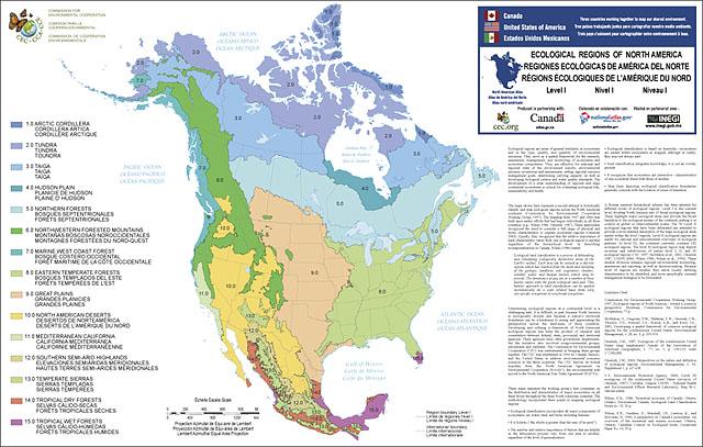
 I’m no expert on ecoregions, but I ran across some cool maps put out by the EPA that define the continent by various ecoregions. Like I said, I’m no expert, so we can learn about them together. It looks like they’re classified into a few levels with each level getting more specific as it goes. Level I is the big picture with just 15 ecoregions for the entire continent. This is, of course, overly simplistic, but it serves as a good starting point.
The Great Plains Trail passes through four of these regions, but mostly stays in (big surprise) the Great Plains ecoregion. The other three it touches are the Northwestern Forested Mountains of which the Black Hills are a part, as well as the North American Deserts, and the Temperate Sierras in southern New Mexico and in the Guadalupe Mountains of western Texas respectively.
The above picture is probably useless. Here is a link to the PDF of the map: EPA Ecoregions Map