
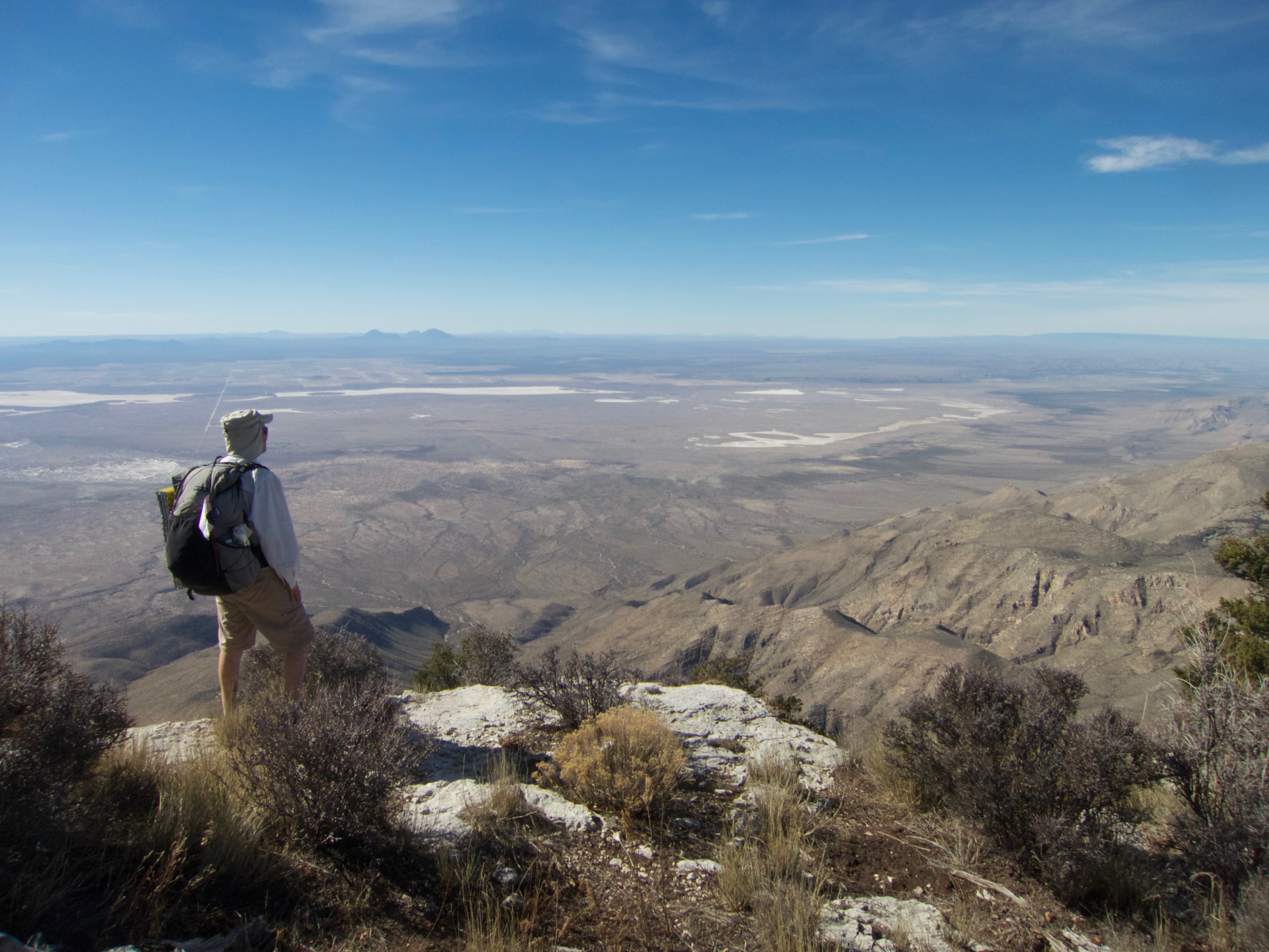
Hikers exploring the southern terminus of the Great Plains Trail are in for something of a jolt. Rising some 3000 feet above the surrounding Chihuahuan Desert, 8749-foot Guadalupe Peak is the highest peak in Texas and the high point of the GPT. It is an uplifted reef stabbing into the sky above the ancient Permian Sea bed that engulfs it. And it contains some of the most rugged country and challenging hiking to be found in the lower 48.

Guadalupe Peak is enclosed within the 135-square mile Guadalupe Mountains National Park, one of the least visited parks in the system. This park, like so many of the lands crossed by the GPT, is lonely country: fewer than 5000 people inhabit the 8000 square miles surrounding it.
But for GPT hikers, this desolation is a feature, not a bug. We like empty spaces, big skies, unimpeded views and the sort of stillness that lets us hear the voices of animals, birds — and the past.
The Guadalupes are a reef that began building over 400 million years ago, when much of West Texas was covered by the warm shallow Permian Sea. Unlike the reefs of today, which are built mainly by corals, these reefs were built from giant sponges and Foraminifera – single-celled protists with shells that can reach several inches in length. From 400 to 250 million years ago, uncounted numbers of these creatures lived, grew and died, all long before there were any dinosaurs. The reef built, layer by layer, the pressure of the shells above turning the ones below into limestone.
And then it stopped. The Permian Extinction, the biggest extinction event the world has experienced (so far) wiped out 96% of these creatures, bringing reef-building to a halt. The reefs were covered by mud and lay silent and hidden while the dinosaurs appeared and then disappeared. An uplift event 20 million years ago brought them to light once more, driving the reef upward to form the sky island that we see today.
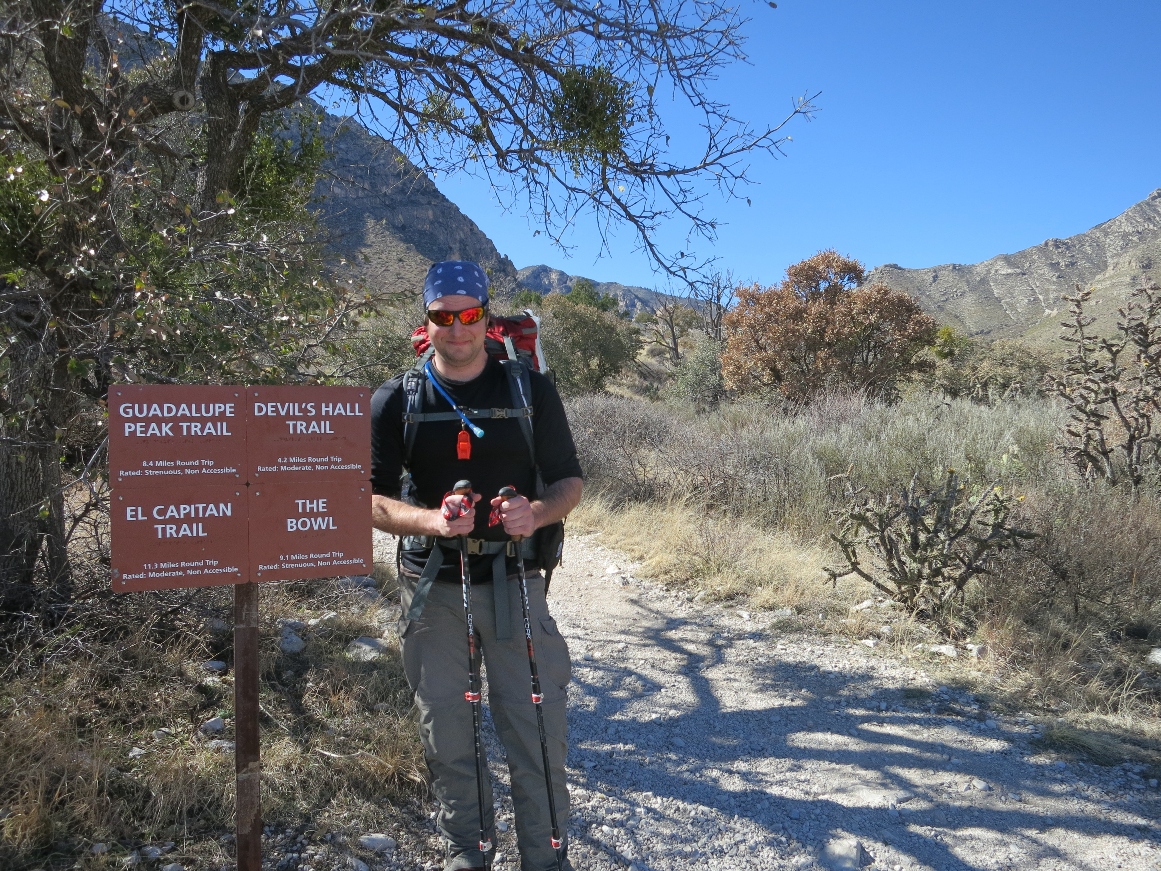
Most hikers will want to launch their journeys from the Pine Springs campground. From there you can make the 3000-foot climb to Guadalupe Peak as a day hike, and return to saddle up and water up before proceeding north.
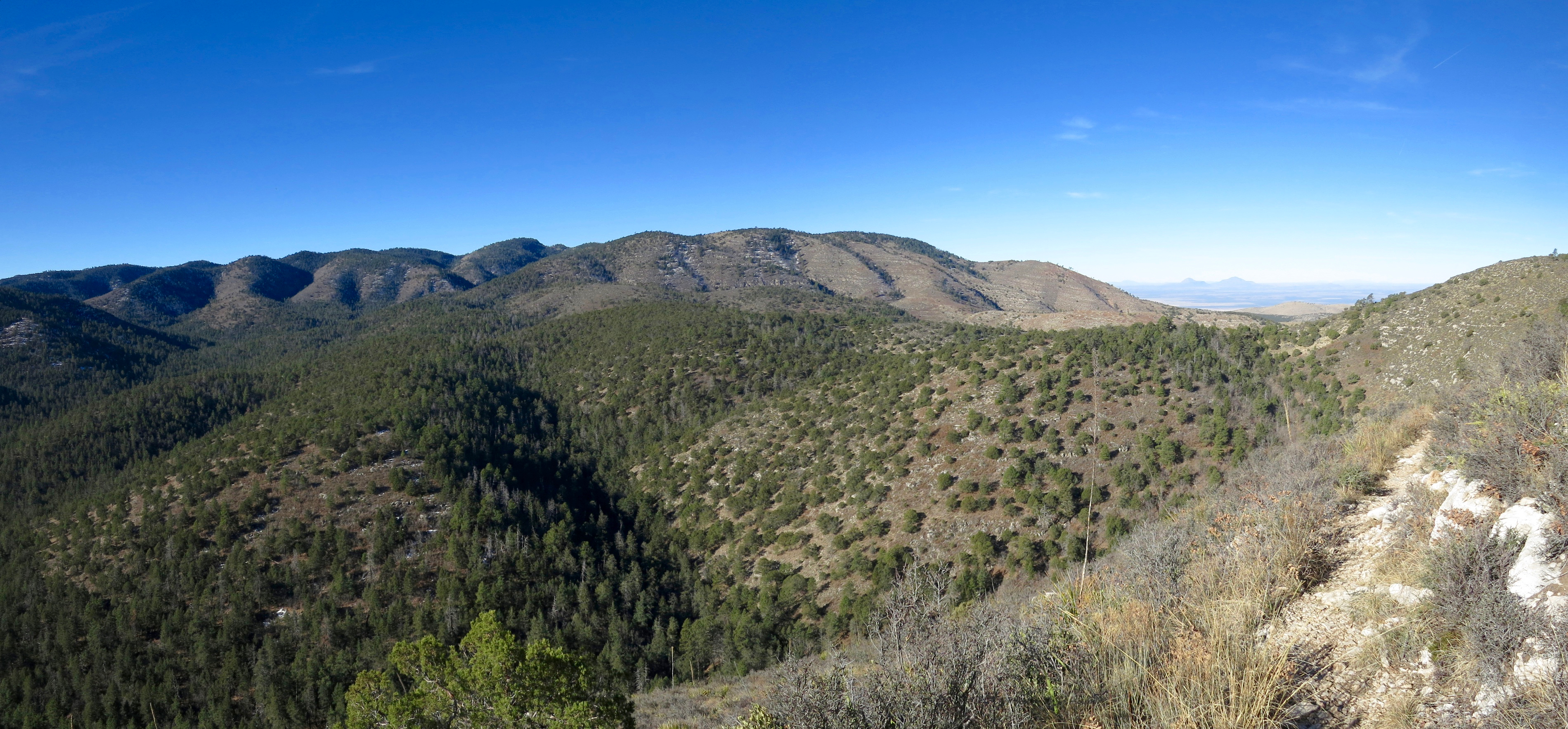
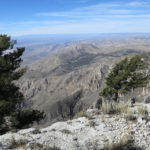
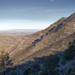
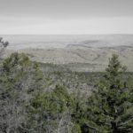
The Tejas trail will take you on a 2400 foot climb up to the rim of the sky island, where you will enjoy hundred-mile views and easy walking through a mixed forest of pines and junipers. The GPT follows McKittrick Ridge to the east, then turns north to drop into and climb out of McKittrick Canyon and up on to Wilderness Ridge. It then heads northwest, following the Ridge, entering New Mexico and leaving the park on its way to The Rim in Lincoln National Forest, which provides great views of this lonely country and is a prime spot for sunset watching.
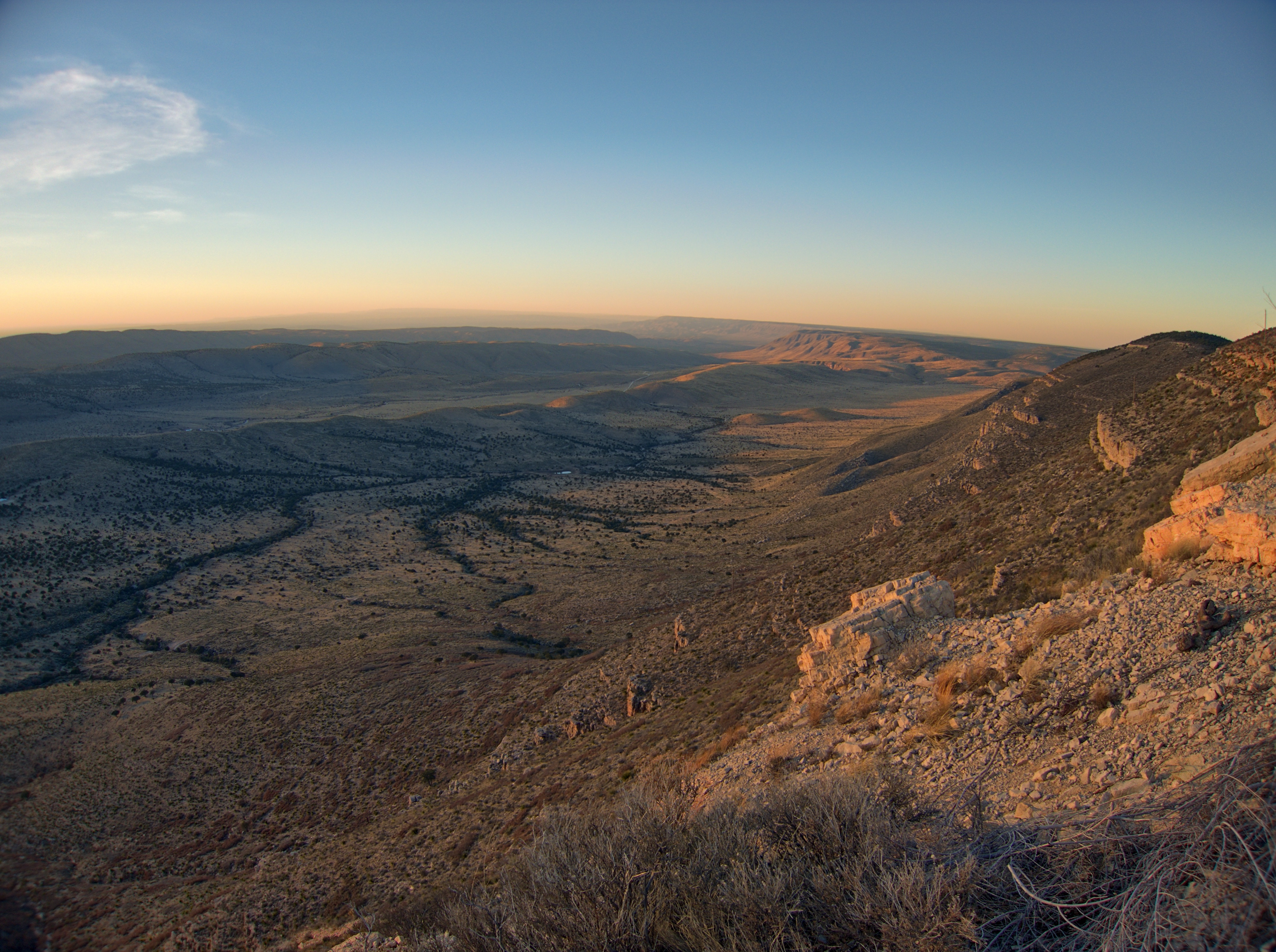
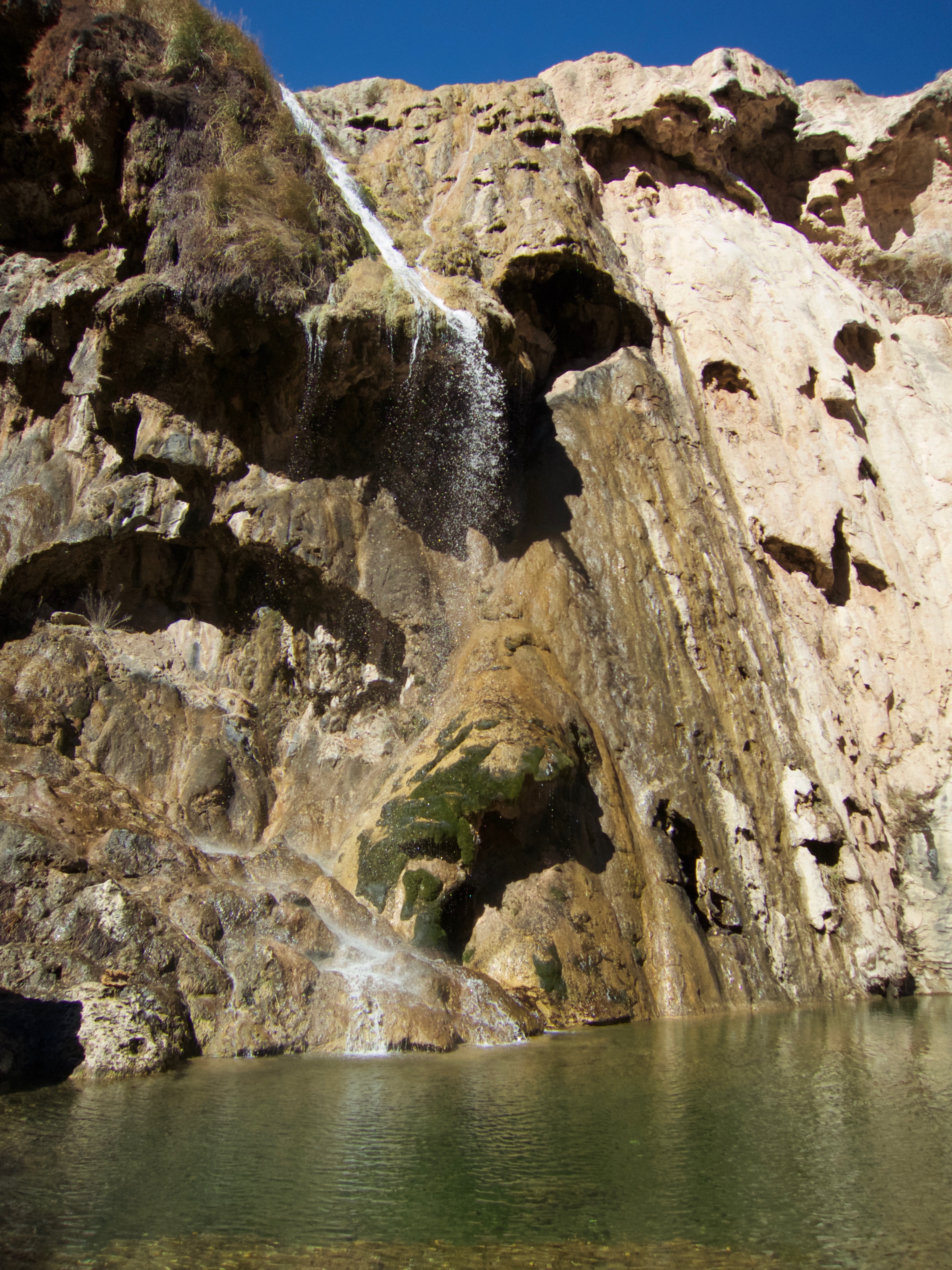
The route follows a network of Forest Service roads through pinyon and juniper country as it works its way north to Sitting Bull Falls. You’ll want to have some water cached along one of these roads, as the first reliable water sources are at the Guadalupe Administrative Center (a one-mile detour) or Sitting Bull Springs three miles farther. A couple of miles of pleasant walking along the spring-fed creek brings you to spectacular Sitting Bull Falls and its surrounding Recreational Area.
The walk down the canyon from the falls marks the end of the mountain start of the GPT and the beginning of the true plains walk as it heads north up the Pecos Valley.
The Guadalupes are a challenging introduction to the GPT. But they embody many of its best features: solitude, wildness, history, and a trove of hidden gems still unknown to much of the hiking community. It is a place that commands respect but also deserves some appreciation.
For Strider’s account of his 2016 thru-hike of the GPT, see his Facebook page
For my account of a three-day loop hike through the Guadalupes, check out TrailGroove magazine here
But first – don’t forget to help us make the GPT a reality
One Response
Excellent post. Beautiful photos too!!