
![]() Happy Trails!: Great Plains Trail Alliance is proud to announce the next section of what will become the GPT. Our goal is to roll out as many of these sections as we can until the entire length of the GPT is complete. This will take some time, and the process will likely start slowly and then build steam and go more quickly as resources and interest continues to grow.
Happy Trails!: Great Plains Trail Alliance is proud to announce the next section of what will become the GPT. Our goal is to roll out as many of these sections as we can until the entire length of the GPT is complete. This will take some time, and the process will likely start slowly and then build steam and go more quickly as resources and interest continues to grow.
A Note on Routing: It is also our goal to have as much of the GPT as possible routed on actual trails. That said, reality will dictate that a significant percentage of the route will need to be on roads. Working with this fact, we will strive to route the GPT on roads that are 1) the most scenic 2) the least traveled and 3) the most expedient for any given area. In most cases, this will mean county dirt roads. In some cases, it may be that there are no dirt roads available, or there may be a short section routed on a paved road in order to enter a town that may serve as an endpoint for a particular section. As the process continues, routing will be continually revised and improved by either adding more trail, or by choosing the best road in an area. As with any long distance trail, this will be a dynamic process. Even long established National Scenic Trails such as the Appalachian Trail, The Pacific Crest Trail, and the Continental Divide Trail are still involved in this process.
Safety: Hiking, Biking, and Horseback Riding involve inherent risks. On any trail, you are always responsible for your own safety. We at GPTA want you to have fun and enjoy the beauty and the adventure of the Great Plains Trail, but we also want you to exercise caution and be smart about the hazards that exist on the Great Plains which include, but are not limited to: weather, wildlife, and water scarcity. Plan ahead and be prepared!
Section (North to South): Edgemont, South Dakota to Toadstool Geologic Park, Nebraska (53 miles – 0% Trail, 100% Road)
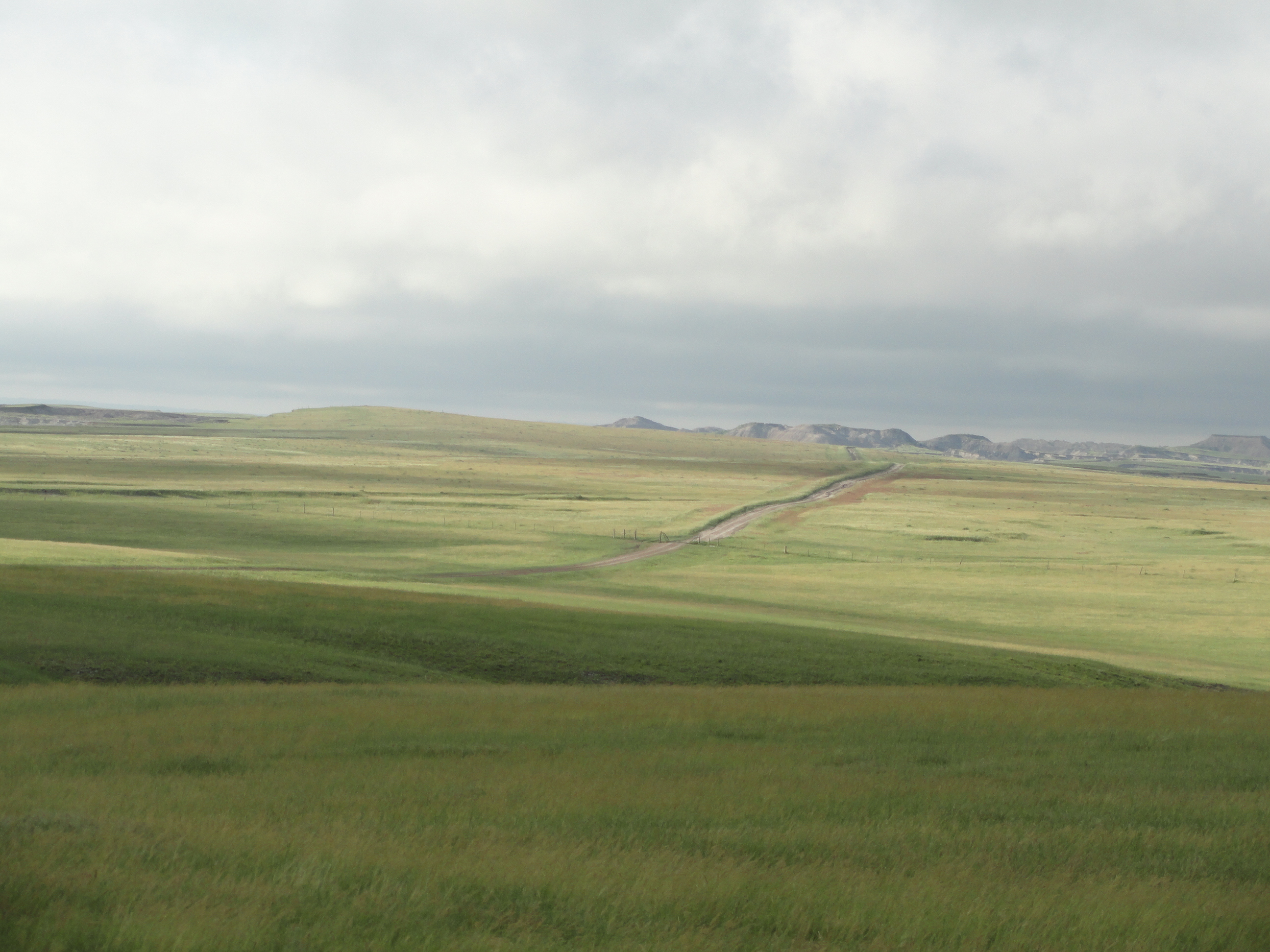
There are some possibilities to create some trail in this section, but for now, it is routed exclusively on roads. However, most of these roads are very lightly traveled, and at times feel more like wide trails.
Name: “Oglala Gap” – The vast majority of the trail runs through either Buffalo Gap National Grassland, South Dakota or Oglala National Grassland, Nebraska.
Open to: Hiking, Biking, Horses (A hiker would not be able to complete this in one day. See Trail Description for potential camping areas).
Elevation Gain/Loss: The lowest point is at Edgemont, SD (3,460 feet). The highest point is along the trail at approximately 3,920 feet. The terrain is rolling with numerous ups and downs, but most of them are less than 100 vertical feet.
Difficulty: Moderate, but the overall length could make it Strenuous.
Highlights:
Toadstool Geologic Park – Amazing eroded formations and badlands.
Warbonnet/Yellowhair Memorials – A short spur hike to a hilltop with the 1876 battle memorial.
Wildlife – Look for pronghorn as they are numerous in this area.
Black Hills – Look for them to the north on clear days, rising from the plains like a vast dome.
Mickelson Trail Connector – The north end of this section (Edgemont) connects directly to the Mickelson Trail, a 111 mile rail trail through the Black Hills.
GPS Map Link: “Oglala Gap”
This is an overview of the GPS file. We hope to improve it soon . . .
Getting There: Toadstool Geologic Park is 17 miles north of Crawford, Nebraska. From Crawford, take Hwy 71 five miles to Toadstool Road. Take Toadstool Road the remaining 12 miles.
Edgemont, South Dakota is in the southwest corner of the state along Highway 18, about 12 miles from the Wyoming border. Edgemont has all necessary services.
Trail Description: (Direction: Edgemont to Toadstool)
Note: Although we will do our best to provide the most reliable and current information, we cannot guarantee conditions as described here. The following information was last updated on 6/11/14
Start at the city park at the south end of town. From the Mickelson Trail mile marker “0.0” sign, head south on paved road 471. Once out of town, this road begins to climb significantly and gains more than 200 feet. This is the only major elevation gain in this section. Follow this lightly used highway about 8 miles to the town of Provo. At Provo, the road bends east, continue to follow for another 0.5 miles.
Leave Hwy 471, and follow the dirt road to the south (Edgemont Road). Continue south for about 11 miles. When road splits, go west for about 3 miles. When road splits again, go south. After about 1.5 miles you will enter Nebraska, but there are no signs to let you know.
Hikers – This area is near the halfway mark of this section. There are public lands in this area, but there are also private lands. Never camp on private land without the owner’s permission. We recommend obtaining a good map of Oglala National Grassland that shows parcel ownership to help you plan for this section.
Ranch roads will appear occasionally heading to the west, but stay south on this road for another 6 miles (it still should be occasionally signed as Edgemont Road). This section is very lightly traveled and the scenery is wide open with many rolling hills.
Edgemont Road continues south, but go east on Montrose Road. After 4 miles, the road splits and Pants Butte Road goes south, but stay east on Montrose Road. After another 4 miles, a small church should appear. This is Montrose and the Warbonnet Memorial is just to the north. From the Montrose intersection, head south on Hat Creek Road. After 3.5 miles, go east on Orella Road. After 10 miles, go south on Toadstool Road for 1 mile. Go west for 1 mile into Toadstool Geologic Park. There is a campground (no running water) at Toadstool.
Photos:


2 Responses
If the awesome pictures are any indication, this looks like a nice addition to the Great Plains Trail!!
I really like it out there!